“There’s got to be a better way!”
This is a phrase uttered in many languages every day across the globe by crop researchers walking through fields assessing plots by eye and by hand. I’ve uttered this phrase myself many times when doing assessments or reviewing data sets that I was trying to merge between different trials.
In a previous role as global agronomy manager for Novozymes, I was responsible for coordinating thousands of biological product trials across the globe. One of our major hurdles to mining the data from the trials to its full potential was the fact that qualitative assessments are not “principled” enough to be interoperable. Basically, each person doing the assessments had different enough rating scales that there was too much noise in the data to confidently identify treatment/germplasm differences and attribute entry, environmental or soil impacts as we required.
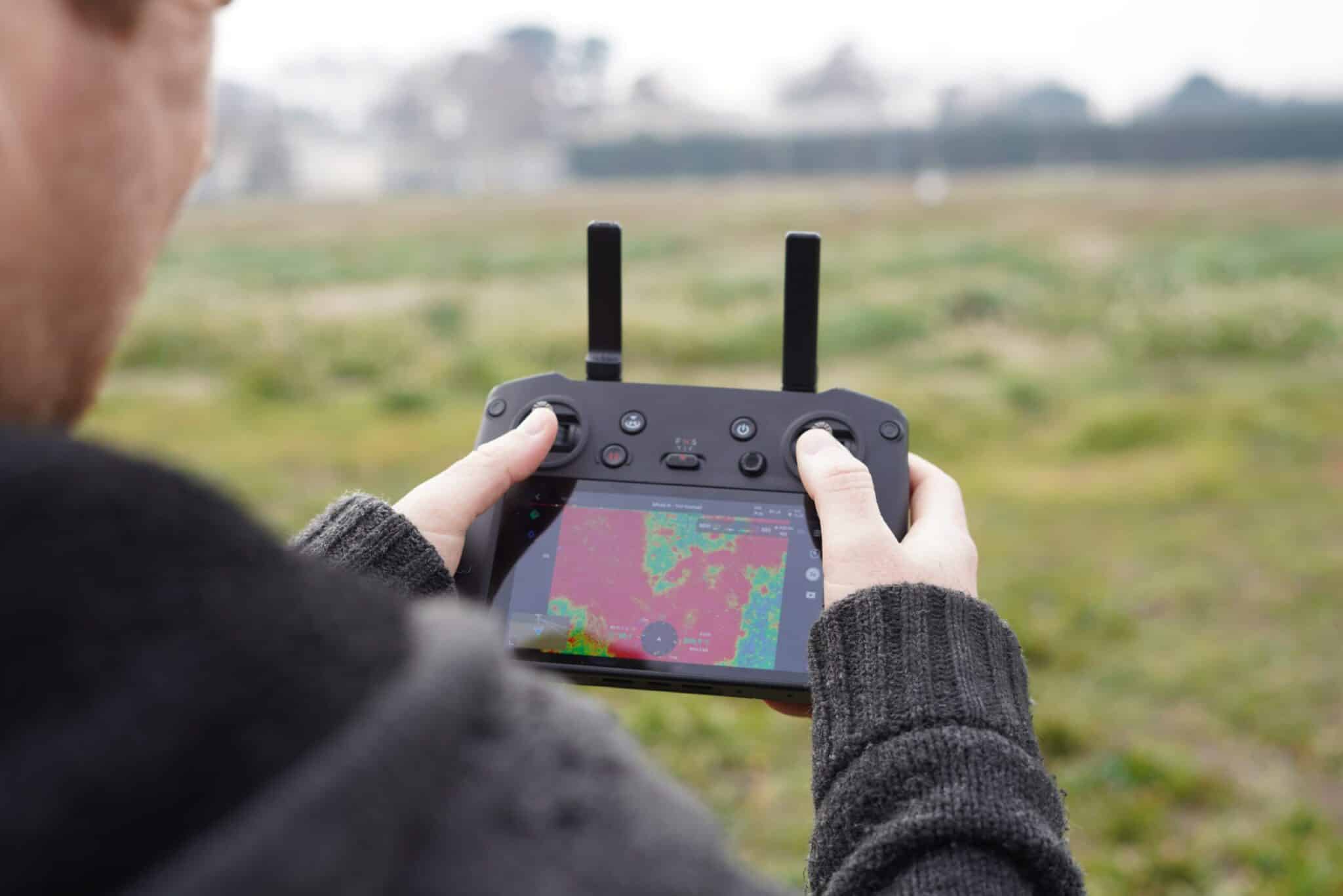
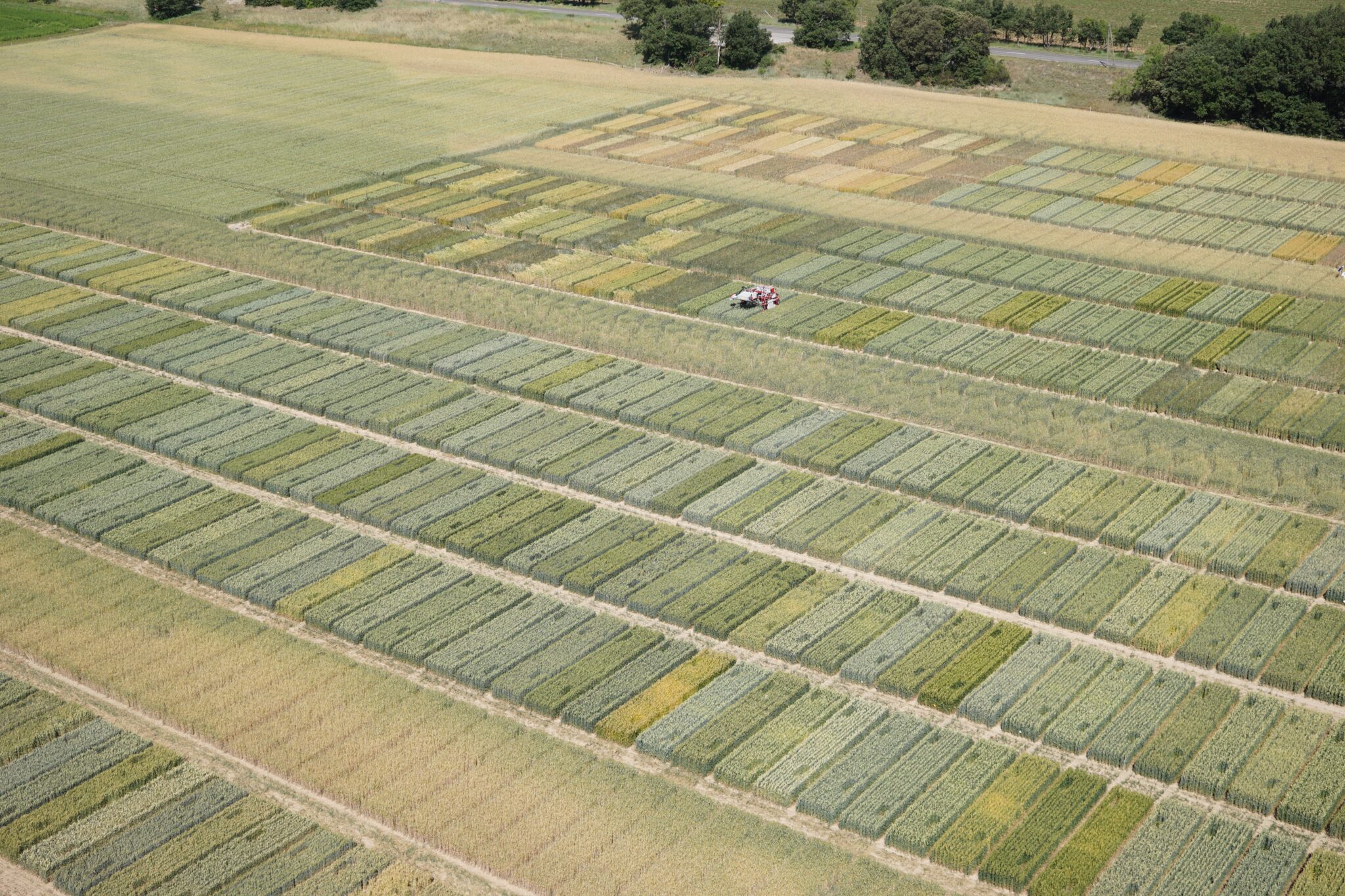
In the ’20-teens, the drone era began to emerge, giving crop researchers a new technology that hinted at solving some of field data collections’ most challenging problems. Early drones were expensive and difficult to operate (likely to crash). The tools to stitch imagery and to georeference and extract traits were very immature and difficult to find and operate. Luckily, that has changed as drone technologies have advanced.
Today’s drones allow high-throughput phenotyping
Drone operational efficiency has now advanced to the point where any researcher can afford and operate their own drone. This means the ability to collect ever increasing quantities of phenotypic data is now accessible to any researcher pursuing high throughput phenotyping.
However, the tools to extract data from the imagery have developed more slowly for agriculture researchers because of the specificity of need and agriculture’s relatively small market compared to public utilities, mining and public safety applications.
Extracting data
Even today, it is challenging for individual researchers to develop and maintain their own pipelines to extract novel insights into the crops they are developing. It was this very need that convinced remote sensing expert Alexis Comar to create Hiphen – the leading global agricultural imaging solutions organization – in 2014.
“Coming out of my PhD work on phenotyping leaf/light interactions with remote sensing, I recognized the value of developing tools that were scalable so that I could help other researchers extract traits from imaging systems in a high throughput way,” he says.
Drones don’t replace researchers; they support them
Though the human eye and interpretation engine (the brain) pick up many insights into varietal differences, we lack adequate ability to measure the reflectance of different wavelengths of light to give insights into varietal differences in a principled and repeatable way. That’s where drone-based imagery excels. And, with proper flight mission protocols, researchers can also extract architectural data like crop height and volume. There’s more: advances in deep learning have allowed advanced counting and classification of plant features from corn stand counts to tomato fruit maturity ratings. And, on the horizon are classification tools to infer stress types like disease, pest, drought and heat.
Yield estimation – the phenome frontier
The age-old breeder’s dilemma has been interpreting how phenotypic assessments can contribute and even drive variety advancement decisions. Phenotyping is labor intensive and training intensive, so historically there have not been many assessments acquired per season. With drones many pieces of information can be collected quickly and repeatably through the season. Already, the application and utility of drone-based imagery is enormous. That will only grow as ever-improving technologies support even more advanced data collection and data extraction.
Lee West is Business Development Director for Hiphen Agricultural Imaging Solutions. He is committed to developing tools that help researchers contribute to the agricultural challenges of the 21st century.
This article is the first in a four-part series on how drones have become a critical tool in the toolchests of crop breeders. The next three will focus on: 1. Image acquisition with drones, 2. Data extraction from drone imagery and 3. Putting that data to work informing advancement decisions.


